
Mobile Monitoring differs from fixed air monitoring stations, in that mobile monitoring can be used to focus on locations with specific air quality issues, roam city-wide or determine local air quality conditions such as near traffic intersections. Mobile monitoring samples at “street level” which reflects exposures of individuals to air pollutants at ground level. The mobile sampling can be used to focus on locations with specific issues or to determine representative local air quality conditions (e.g., at traffic intersections) which are common issues in numerous areas across this and other cities. Recent mobile monitoring studies from around the world have shown that the short-term, peak exposures that are experienced near air emission sources can have serious detrimental health impacts in some individuals.
Between late 2004 and 2008, mobile monitoring surveys were undertaken for Clean Air Hamilton to obtain a comprehensive picture of the air quality across the City of Hamilton, in particular air and health impacts due to traffic emissions and atmospheric inversions conditions. This study determined local exposures to health impacting air pollutants in normal life and thus allowed citizens to practically reduce these exposures such as by using the recirculation on their car’s ventilation while on highways. The graphical/GIS presentation of data made the results very clear so that the numerous recommendations from the study could be acted upon by City staff and politicians.
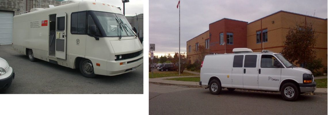
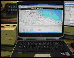
The mobile monitoring vehicle is outfitted with a Global Positioning Satellite (GPS) detector and modified to support a data acquisition system and a data storage system. Data can be collected using various real-time monitors on board the vehicle to measure NOx (nitrogen oxides), SO2 (sulphur dioxide), PM (airborne particulate matter) and CO (carbon monoxide) simultaneously. Figure 1 shows the mobile unit that was outfitted with the real-time air monitors and a meteorological station. In Phase 2 of the study, some of the monitoring systems were upgraded and outfitted with a better data collection system that is capable of simultaneously storing air pollutant data and global positioning satellite (GPS) data; the GPS data is used in collaboration with an enhanced geographic information system (GIS) program to allow for the mapping of air pollutant data locations.
Figure 1: Mobile Air Monitoring Unit and the Real-time Display on a Laptop Computer
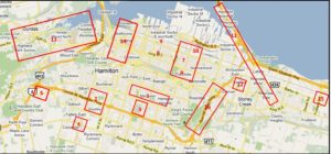
In 2010-2011, 11 different areas of Hamilton were sampled using the mobile monitoring to identify the day to day health impacts of air emissions in their lives. A map of these areas can be found at http://g.co/maps/m5nj4
This work was undertaken in partnership with interested and concerned neighbourhoods in Hamilton and sponsored through ArcelorMittal Dofasco’s Community Grant.
Figure 2: 2010 Target List for Neighbourhood Mobile Air Monitoring
You may view the results of the mobile monitoring studies, which are available on the Research page under Reports and Resources
Green Venture